Bay State Village
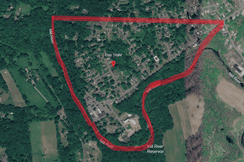
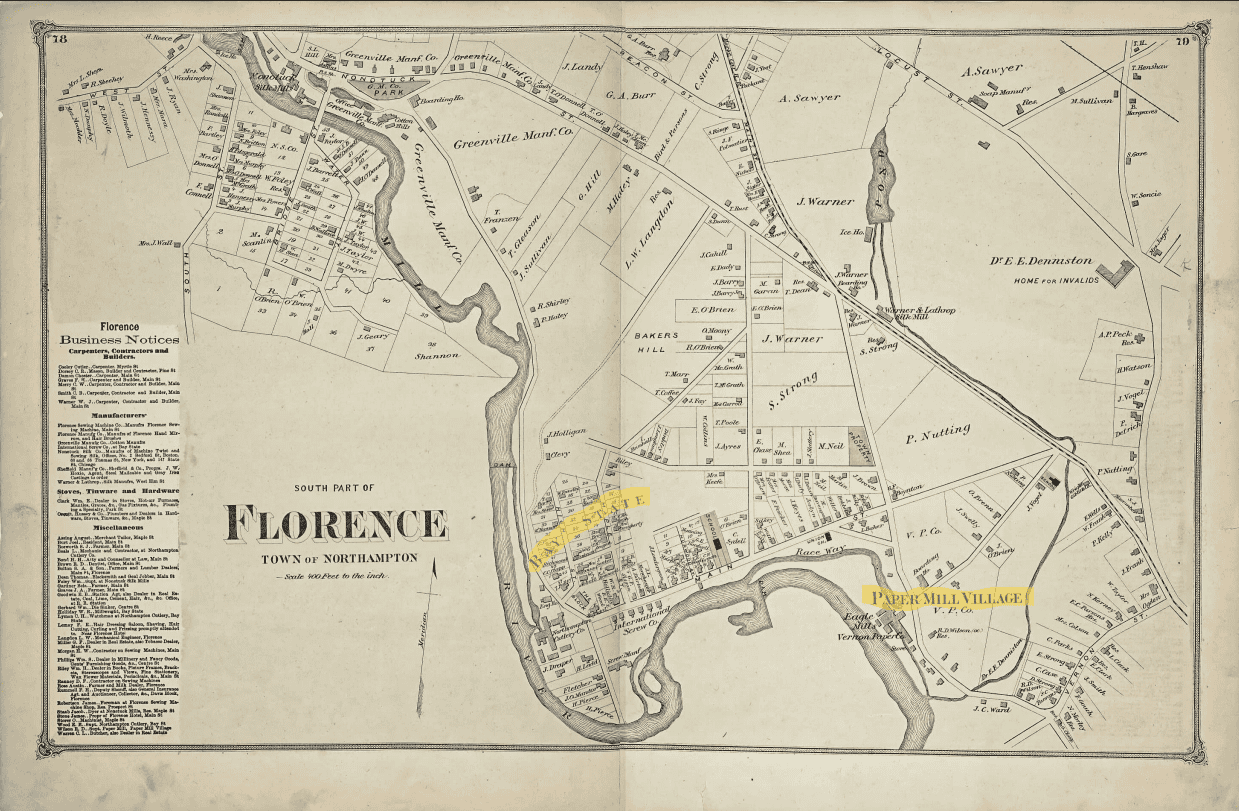
Left: Google Earth image. Right: Map of Florence from the County Atlas of Hampshire Massachusetts, F.W. Beers & Co., 1873. Historic Northampton (ID no. 1976.155.5).
The boundaries of Bay State Village have never been firmly established and are still disputed. The [red] lines on the [Google Earth] map above are generally accepted today as Bay State Village. It incorporates the former Paper Mill Village and ‘Victoria Bismarck,’ the neighborhood that grew up across the river after the Clement Street Bridge was built in 1895.”
— BSVA Archives
18th Century, Early Industrial Development
Development of industry in the area now called Bay State Village began early in the 18th century with the fulling mill. Built about 1702 and situated on today’s Federal Street, it was the first mill run by a waterwheel this far upstream on the Mill River. Women spun thread and wove it into cloth at home, then sent this cloth to the mill to be “fulled,” that is, shrunk and thickened by moistening, heating, and pressing.
William Butler, founder of the Hampshire Gazette, built a papermill in 1785 on the same site as the fulling mill. All the paper for the Gazette was made here. Paper was made from rags collected by the employees. Rollers driven by the waterwheel crushed rags into pulp. Converting the pulp into paper was done by hand. An 1830 map of the area shows no appreciable development yet beyond the paper mill. There may have been farms, but there are no streets or roads shown.
Various industries have been located on this site ever since. In the 20th century, it was the site of the Electric Wire Company, and in the 21st century, the site was home to O’Rourke’s Driving School.
19th Century, Rapid Growth
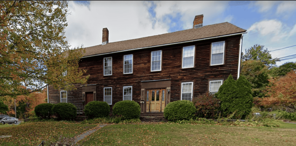
By 1831, the Butler Paper Factory employed 27 men and women. Men earned one dollar a day; women earned 32 cents per day. The surrounding neighborhood became known as Paper Mill Village. A boarding house was built at the corner of Federal and Milton Streets to house paper company workers. The big brown house still stands.
Meanwhile, 1838 saw Joseph Warner dam Broughton’s Brook, which ran through land off of Elm Street, now owned by Smith Vocational High School. With that water power, he opened a silk mill with boarding house accommodations provided for his workers. Warner operated the silk mill until his death, when his son Luther J. Warner took over the business. Luther Warner joined in partnership in 1882 with John N. Leonard, and the company took the Leonard name, John N. Leonard & Co. By 1890, when its name became Leonard Silk Company, they built a completely up-to-date steam-powered mill complex that spread over five acres. The company made sewing silk and machine thread.
In June 1891, only 14 months after the new mill was celebrated, Leonard’s Silk Mill suddenly went bankrupt. In spite of Leonard’s efforts to reorganize and to raise money from investors, the factory went under. Then in 1895, the building burned to the ground and the site was bought by the Nonotuck Silk Company.
Heavy spring rains in 1906 caused Warner’s then 68-year-old dam to collapse, flooding the meadows of Bay State Village between the hospital and the river. By a blessing of geography, Bay State had been spared death and destruction when the Williamsburg dam broke, causing the disastrous flood upriver back in 1874.
The Vernon brothers had bought both paper mills in 1845. They installed a 25-horsepower steam engine to use when the water level dropped too low to run the mills’ waterwheels. One of their products, called Eagle Paper, was considered as fine a quality as any paper made in this country.
The Northampton Cutlery
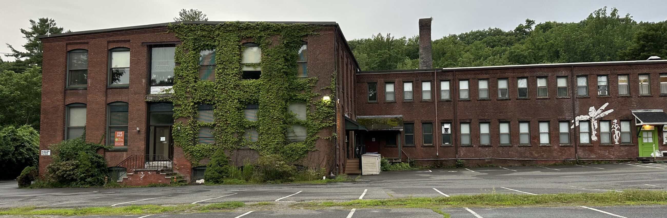
Baystate Tool Company was founded in 1854 employing 150 workers. It was the first of several cutlery mills run by water power on the Mill River. Housed in the building that stands on Riverside Drive today, the factory made farm tools like shovels and hoes. During the Civil War, it switched to manufacturing gun barrels, bayonets, and sabers. The owners were, like other early entrepreneurs, men whose names have lived on in our streets and schools—William Clement, Charles Maynard, Jerome Jackson, and later, H.R. Hinckley.
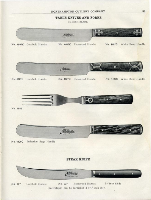
1871 saw the Baystate Tool Company become the Northampton Cutlery, producing fine tableware and hunting knives. The knife plate and fork tines were made of stainless steel, then sold to silver companies such as Reed and Barton, who added silver handles.
19th-century census records show that many Bay State residents came from Ireland during the potato famine years, and more came from French-speaking Canada. For example, one page from the 1880 census taken in homes close to the cutlery shows 26 out of the 50 residents enumerated were immigrants or the children of immigrants. Of those 26, 23 came from Ireland or England, and three from Canada.
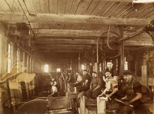
Much work at the cutlery was highly skilled and done by hand. Those skilled craftsmen came from Sheffield, England, and Solingen, Germany, from families who had worked as grinders and platers for generations.
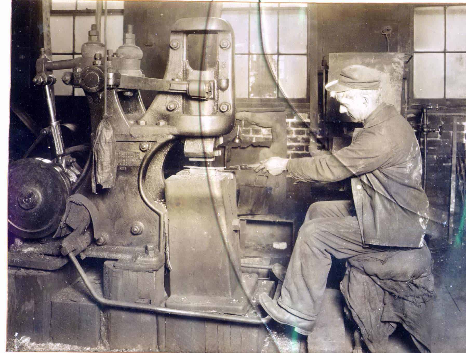
The cutlery jobs were forging, grinding, buffing, plating, and polishing. People worked 12-hour days. Grinding and polishing required more skill and earned $12–$18 per week. That’s 18 to 28 cents per hour. Many workers suffered—and died—from “grinders consumption.” There were also children as young as 10 years old working in the mills. As workers’ conditions improved and silver prices rose, production became less profitable, until 1986, when the Northampton Cutlery closed its doors.
Many of the cutlery workers hoped to bring family from back home to the U.S. eventually, and they needed to stay in touch. With 12-hour workdays and the only post office a long walk or bike ride downtown, mailing and receiving letters was difficult. In 1888, workers went house to house with a petition asking for a post office. There followed much debate over how their letters would be addressed.
Then on February 14, 1888, the Gazette printed a notice, “All letters for people here should be directed to ‘Baystate, Mass’.” The post office was in the village store (known to many as Smitty’s after 1975). It was located directly across the street from the Cutlery.
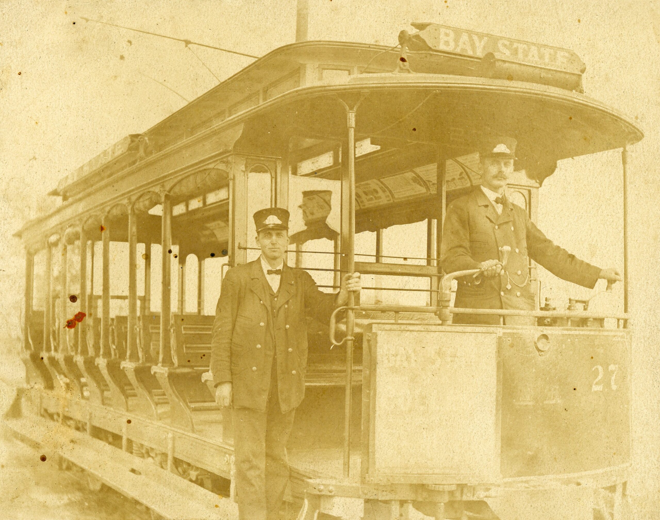
Butler’s paper company had been destroyed by fire in 1889. Edward Wood rebuilt and started another mill that made fine cutlery on the same old paper mill site. He was the first businessman in town to use oil instead of coal to heat forges. He also operated a grocery store and was chief of the fire department. The beautiful old fire house still stands next to the cutlery building on Riverside Drive, crowned by its historic bell tower.
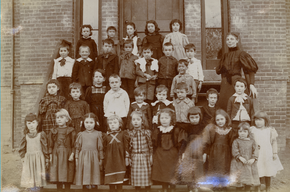
Baystate Village Schools
In the area, were also two schools serving the community. One, the original Bay State School on Main Street (now Riverside Drive), was built in 1869 to serve about 100 children in seven grades. These children and their teacher were photographed in 1896.
The school building was demolished in 1929, replaced by the present building, and renamed in 1955 for mayor William Feiker, who came from an old Bay State family. The Feiker school closed in 1975, but the building continues to serve as the Nonotuck preschool and community center.
The other school, called the Papermill School, was located in what would now be the parking lot of Northampton High School. It was a classic one-room school house with a woodstove and an outhouse.
For many years there had been a brickyard at the foot of what is now the high school hill, across from present-day Greg’s Garage. In 1885, William Bailey and Jeremiah Brown bought the brickyard, converted it from horsepower to steam, and began producing millions of bricks. These bricks were used to build the Forbes Library, Smith College buildings, Clarke School, First National Bank, McCallum’s (now Thornes Market) and the Blessed Sacrament Church.
Wet bricks, made from the clay of a nearby hill, were laid on rows of parallel racks six feet high and covered with pointed roofs. Huge log fires were built in the ditches below those racks to dry the bricks. After dark, neighbors would gather on the hill above to see the racks silhouetted against fire and sometimes a workman pushing a wheelbarrow through the inferno. The brickyard went out of business in the early 1900s.
Transportation
The Northampton Street Railway, which had been using horse cars for public transportation beginning in 1866, converted to electric trolleys in 1893.
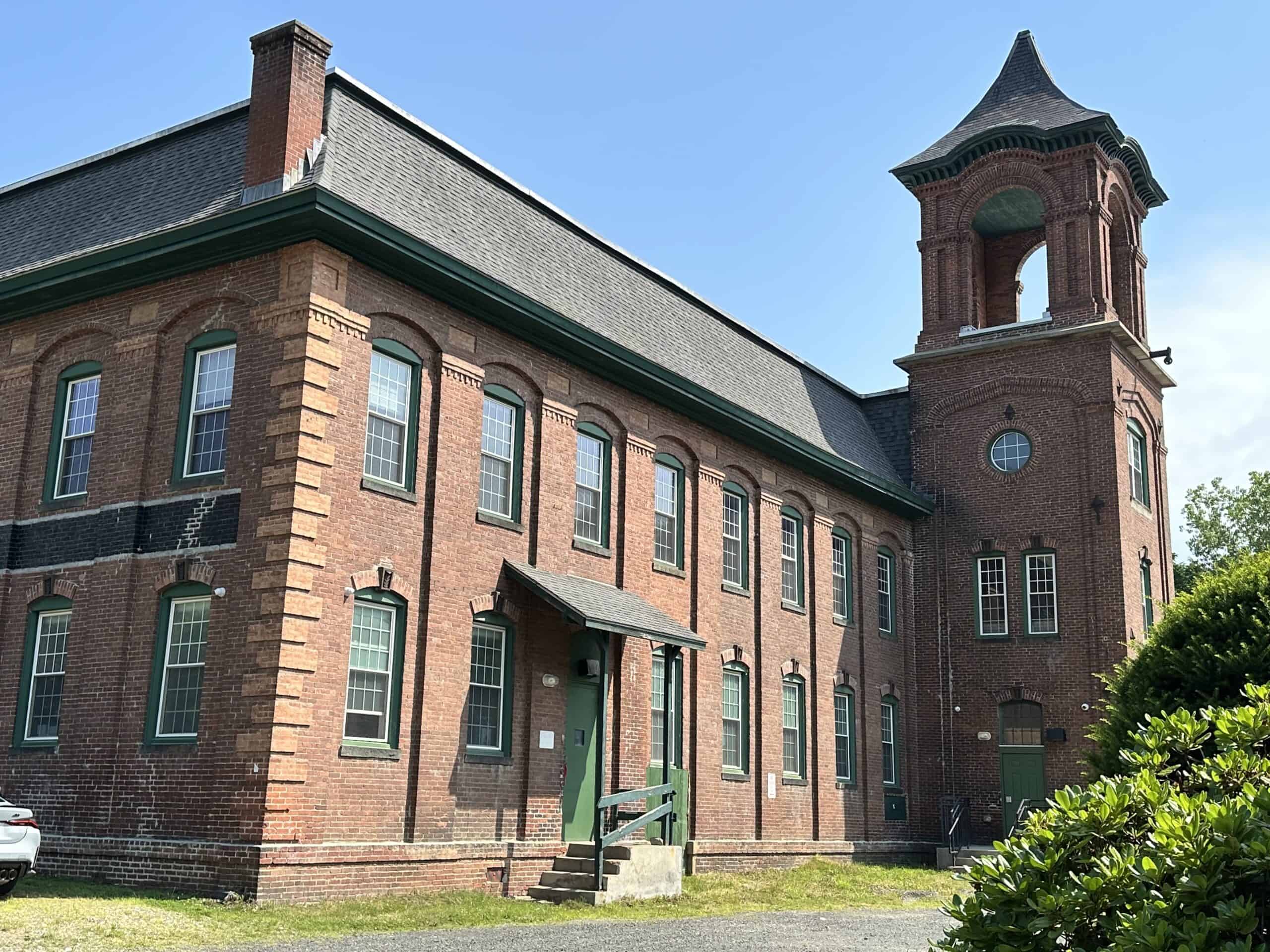
There were “closed cars” for winter travel and “opens” for the summer. According to Northampton historian Alice Manning, “For pure traveling pleasure the open car was like nothing else that ever was invented.” Street cars named Bay State, as pictured, eventually connected the Village with Northampton and other points as far as Williamsburg, Greenfield, and Amherst for mere pennies. The end of the line was in front of the Bay State village store. Trolleys were done in by the coming of the automobile and the Depression, and they stopped running in 1932.
The growth of industries in Bay State Village in the mid to late 19th century naturally led to increased traffic in the area. Bay State villagers had to make detours of several miles to cross the river. There was some community agitation around this inconvenience. In 1893, Mayor John B. O’Donnell’s annual address included the following statement: “…a bridge ought to be provided somewhere across the Mill River between the Old Bridge and the Railroad Bridge. I think it would be well to have the whole City Council meet these people…to decide this question.”
The city went ahead with a plan to build a new one-lane bridge. According to the city engineer’s report of 1894, “a new iron bridge over the Mill River at Bay State…has been completed and a new street graded.” The new street, built to serve the bridge, required the labor of “30 men and five teams,” and it was named Clement Street. The city treasurer’s report of the same year indicates that the bridge construction cost $3,433.23. Unfortunately, there is little other documentation related to the original construction of the Clement Street bridge, and the engineer and builder remain unknown.
Bay State Today
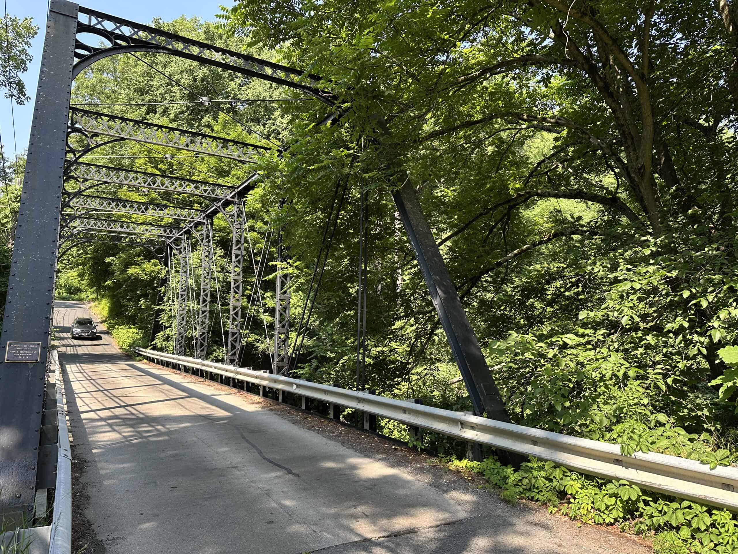
The Clement Street bridge has served the Bay State community throughout the 20th Century and into the 21st. In 2014, neighbors submitted an application to list the bridge in the National Register of Historic Places. A clerical error at the Massachusetts Historical Commission put the paperwork in limbo until a follow-up inquiry was finally made in 2023. Whether or not National Historic Registry status is pursued, the bridge is both a neighborhood treasure and a frequently used shortcut between Easthampton and Florence.
A city report from 1991 evaluated Bay State Village for Local Historic District status to preserve a community that still offers a look at a traditional 19th-century New England mill village. The unique natural and built landscapes of Bay State Village continue to remind residents of the history, drama, and quintessential character of small-town New England life as experienced by our ancestors.
Many of these 19th-century factory buildings and houses still stand in a streetscape that evokes a feeling for life in those times. While the community no longer has its own post office, the original village store and post office building still serves the community, currently in 2023, as a popular Vietnamese restaurant.
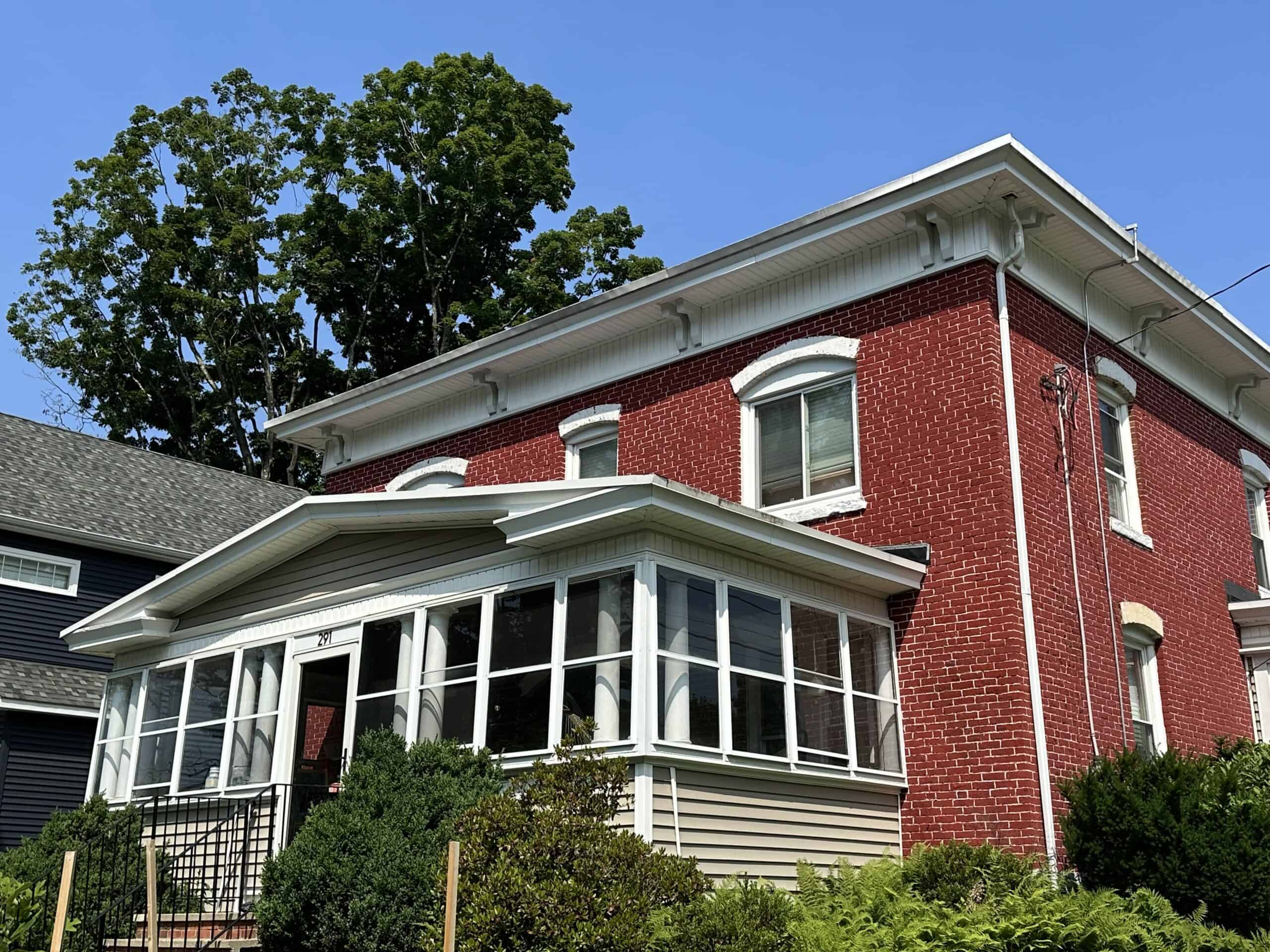
One can find houses on Google maps that match the homes on the old Bay State Village maps. Two examples from Riverside Drive reflect the class divide. The brick home was a mill manager’s house, built in 1870.
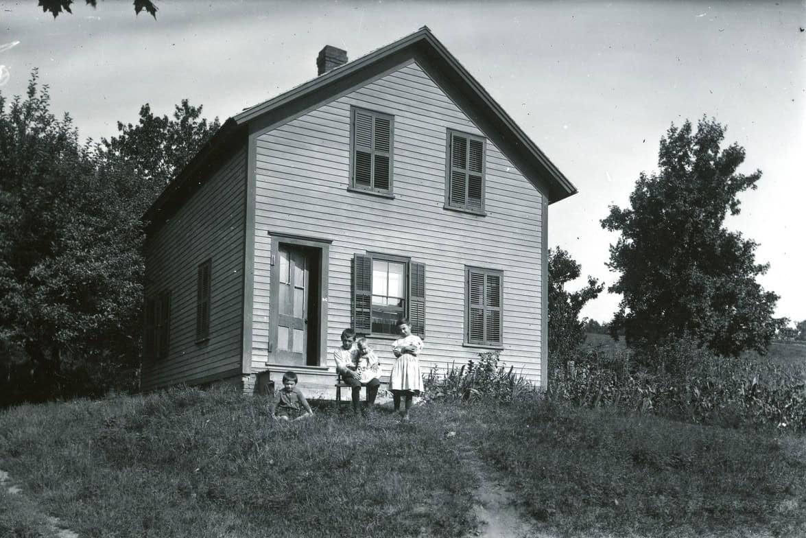
It faces six cottages across the street that were built in 1860 for workers of the International Screw Company. Many of Bay State’s early cottages were like these: a story-and-a-half, with stone-walled, dirt-floor cellars and traditional New England clapboard siding. Sometimes the cottages were home to factory workers’ widows who took in boarders for income.
Modern residents of Bay State Village proudly display a 58-foot-long “Wall of History” each spring and fall at neighborhood gatherings. It is that same “Wall of History” which inspired this treatise.
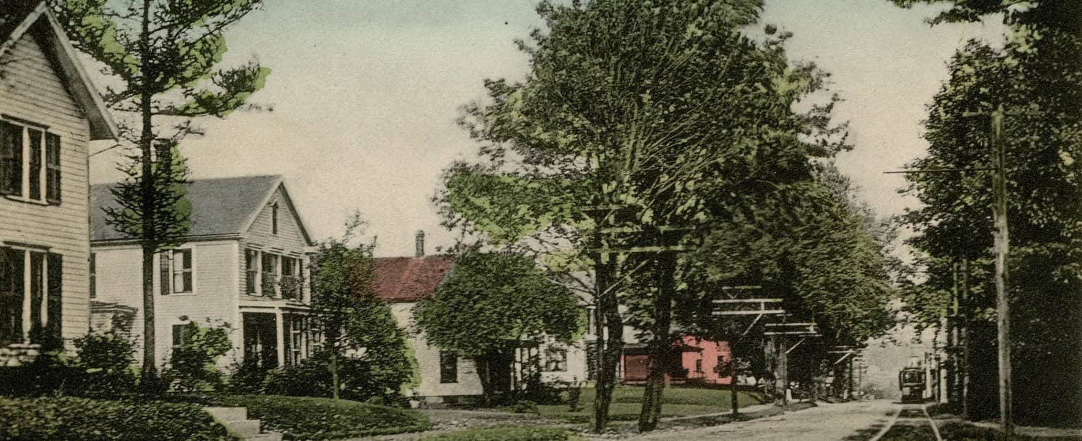

This essay is dedicated to and dedicated to BSVA members Sue Norton, Alex Ghiselin, Diane Welter, Peter Mclean, and Karen Fiegenbaum, who created the BSVA “Wall of History” in 2020.
ADDITIONAL RESOURCES
Bay State Village Association Archives
City of Northampton Local Historic Districts Final Report, May 1991.
Hannay, Agnes. A Chronicle of Industry on the Mill River. Smith College History Department, 1912.