The Belt
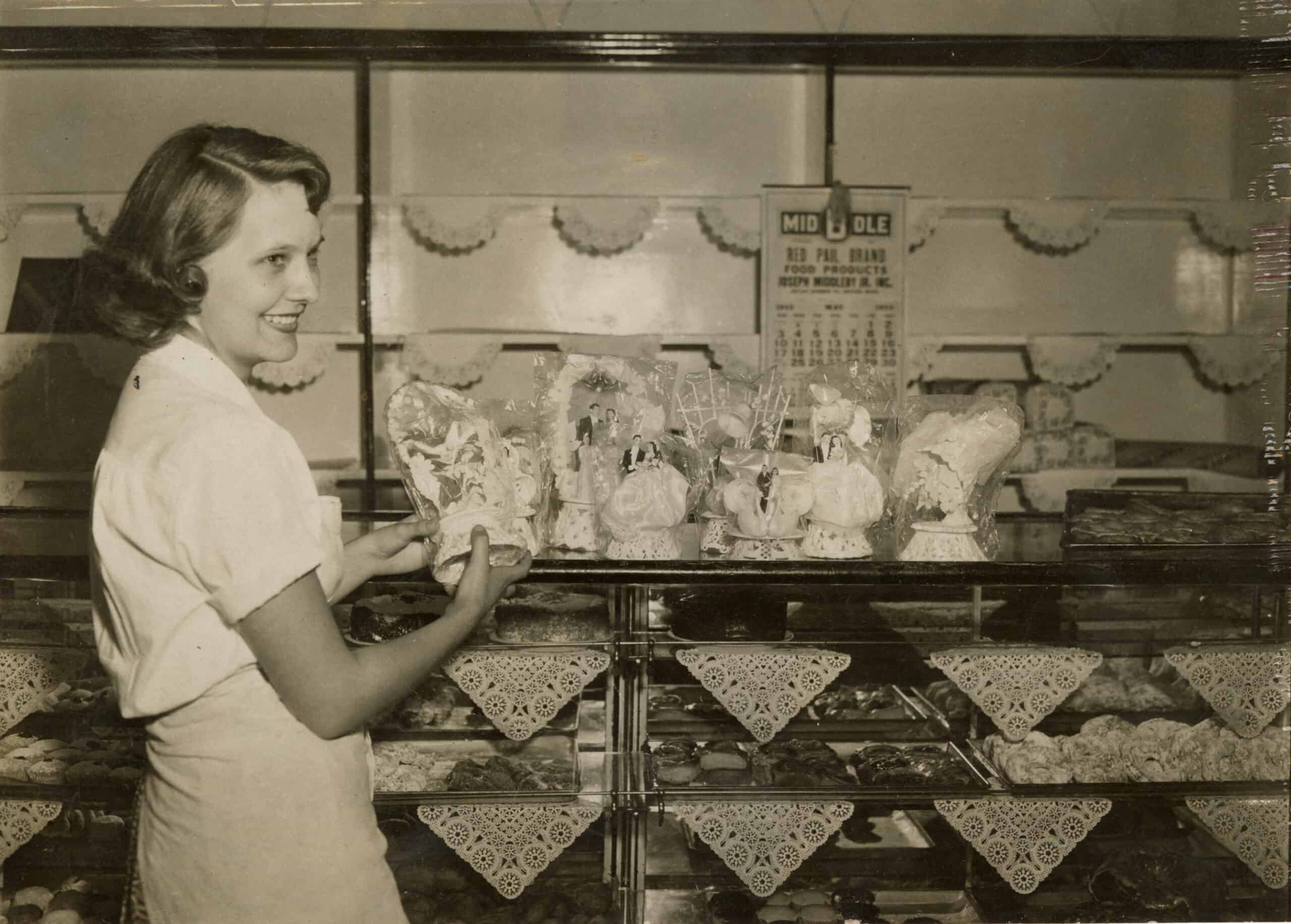
In this article, the author reflects on the section of Northampton where a large percentage of working people lived. It first appeared as a guest column in the May 28, 2013, Daily Hampshire Gazette. Szlosek is a retired attorney and lifelong resident of Northampton.
A few weeks back, I purchased a copy of the new pictorial history of Florence (Images of America: Florence by Jason A. Clark and Craig P. Della Penna). It was nicely done and it was fun to read. It got me thinking about the section of Northampton where I grew up, the “Belt.” That’s a term you seldom hear in Northampton any more.
Most residents know where the West Farms or Bay State neighborhoods are located. It was once also that way for the “Belt,” but over the decades that name seems to have fallen into disuse, especially after the railroad overpass across Pleasant Street was removed. That overpass marked the most visible entry into the Belt, and was its most northern edge.
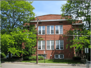
Today, the best way to define the locale is this: If you lived in the Williams Street School district, you lived in the Belt.
When I got to high school [in the 1950s], I realized that the Belt had a pejorative connotation for many of my fellow students, something akin to living on the wrong side of the tracks. They seemed to think it was a rough-and-tumble part of town, which was certainly news to those of us who lived there.
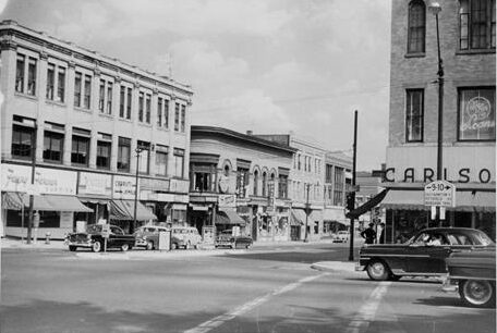
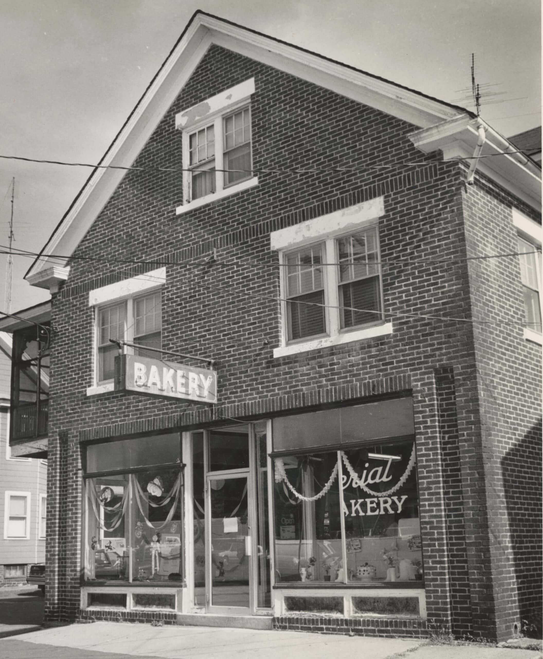
Certainly there were a half dozen bars and the occasional Saturday night drunkard, but also service stations, three corner groceries, the Sanitary Laundry, the Clark Coal Co., Al’s Snack Bar, Mike the barber next door to the great old shoemaker, Mr. Himmelski, and my family’s Imperial Bakery.
There were no street gangs or weapons, and I always felt safe walking and biking the streets at all times of the day.
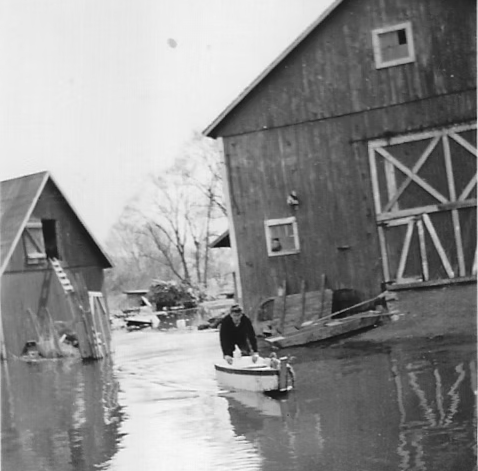
A contributor to the negative image of the area was undoubtedly the history of flooding that lower Pleasant Street and environs suffered. Before it was diverted to its present course, the Mill River flowed through the center of Northampton and was the western edge of the Belt. When the Connecticut River would undergo its annual flooding, there was no place for Mill River waters to go except over the meadows and streets of the area. There were some especially nasty floods in the 1930s and, if you walk down Pleasant Street, you can see a high-water mark on the site of the Northampton Lumber building.
I recall seeing old newspaper pictures of people in rowboats all the way up to Pearl Street. My uncle and father told me they had to take the bakery supplies and carry them to the second- and third-floor living quarters in 1938. My mother told me that, when she was pregnant with me, she carried buckets of fillings up the stairs when there was concern of another flood in 1939.
By the end of World War II, the Mill River had been diverted, the dikes built and street flooding was a thing of the past. There had been an old iron bridge, the Wright Avenue Bridge, over the Mill River that went from Pleasant to Wright and then to Conz Street. That was the course of the old Route 5 and it was the principal north-south road in town.
With the river gone, it was decided to remove the bridge and, in 1953, the Belt changed forever. The homes on Fulton Avenue disappeared and Pleasant Street became a straight shot from Main to the dike. Many houses vanished almost overnight and new buildings and businesses sprang up. Businesses such as the once popular hangouts A&W Root Beer and Riatta drive-ins would never have existed without the straightening of the street.
I was always curious where the term “Belt” came from. My assumption was that it referred to the local bars and that it was the section of town people frequented to get a “belt” of liquor after the day’s work.
Others had a more benign explanation. My late cousin Wally Novak, who was a star athlete at the high school and Trinity College, grew up on Pleasant Street. He always said to me, “the belt holds up the pants of Northampton.” It was an interesting line but I could never quite see what he meant. Recently, another former resident said to me, “the belt held Northampton together,” and suddenly I had an insight.
The Belt was the section of town where a large percentage of the working people in Northampton lived. These were the folks who worked in the factories, the farms, at the state hospital, and at Smith College, and they did it day after day, year after year.
These were the ones who performed the little-noticed, indispensable tasks that kept the city humming along. Maybe these workers really did hold Northampton together.
I know this. We were all proud to come from down there and we produced our share of athletes, college students, teachers, nurses, lawyers, and business people, including a mayor, city councilors, and military academy appointees. A large percentage of us continued our education past high school, a tribute to our hard-working parents and the dedicated teachers, especially longtime principal Helen Ryan, who taught us at the Williams Street School.
After all these years, the highest praise any of us who grew up down there can still receive is the statement, “The kids from the Belt, they did all right.”
ADDITIONAL RESOURCES
Daily Hampshire Gazette, “Stories bring the neighborhood home: ‘The Belt’ online oral history project shares Montview residents’ recollections of quirky riverside enclave,” March 22, 2024.
“The Belt: An Oral History Project of the Montview Neighborhood,” Digital project.